Antarctic Art and Holiday Festivities

On Christmas Eve our team pulled off WAIS Divide’s first art exhibit! Fifteen ice inspired art pieces from artists based in New Zealand, Canada, and the USA were displayed out against the sprawling white and blue backdrop of the WAIS skyline. The pieces were a variety of mediums- prints, photos, videos, collages, paintings, as well as a quilt and a canvas cyanotype, which we draped over a set of bamboo poles so that people could walk beneath it to see the light shine through.

Canvas cyanotype

Canvas cyanotype

The quilt was sewn by community members in Alaska. A painting of WAIS Divide’s Tent City (a fan favorite amongst the WAIS camp staff) was from an undergrad artist. Several pieces were from invited artist Anna Mckee, who shared prints depicting ice crystals, frost, and sea ice. In submitting their artwork, each artist offered their unique perspective on ice cores, ice sheets, and ice crystals, giving those of us out here on the ice a different kind of appreciation for the landscape and microstructure we have spent our days examining. 

Erin and company setting out the artwork

Erin and company setting out the artwork

"Morning Clouds Over Tent City" watercolor 

"Morning Clouds Over Tent City" watercolor 

Camp staff looks at some of Anna McKee's prints

Camp staff looks at some of Anna McKee's prints

Next to our logging tent is a warming hut, normally cluttered with our logging tools and equipment. For the art exhibit it was transformed into a reception hut. Wine, chocolate, and cheese replaced sonic loggers and acoustic televiewers. Garlands and ornaments were draped across the drying racks and tent frames. When the camp staff began to make their way out to our tent we all gathered in the warming hut before starting out together (all in our big reds) to walk through the exhibit. 

Everyone dressed up in their finest Big Red for the gallery opening

Everyone dressed up in their finest Big Red for the gallery opening

The exhibit extending out into the white abyss

The exhibit extending out into the white abyss

We could not have asked for better weather; the lingering clouds from earlier in the day cleared up just in time for everyone’s arrival. The sun lit up pieces from the front and the blue sky framed them from behind. Pictures will be up as soon as we return to wifi! Until then, we are thankful for our friends and family who have generously taken the time to type up these blog posts that we have been dictating over the phone.

"Cold as Ice Blues" a paper collage

"Cold as Ice Blues" a paper collage

A rare sighting of the Antarctic Gorilla, known to be attracted by paintings and prints

A rare sighting of the Antarctic Gorilla, known to be attracted by paintings and prints

The art exhibit was one of several holiday events this weekend, and was a fun way for camp staff to spend their afternoon off. Earlier that same morning we took part in intercontinental caroling. McMurdo and the other Antarctic field camps tuned in to the HF radio to take turns singing carols and sending holiday greetings to one another. 

The night prior, we had the WAIS Divide christmas dinner. The entire camp gathered in the galley, where the cooks had prepared a delightful meal and desserts that were out of this world. With full bellies and high spirits we followed up dinner with a White Elephant gift exchange. Overall, it was a wonderful and unique holiday celebration! 

In other news, we have finished up with the acoustic televiewer and for the next week we will be working on the sonic logger and radar, before we head back to McMurdo. 

Snowy o-WAIS-is

Greetings, from our snowy o-WAIS-is! It is a bright sunny night here and our field work is finally underway. Yesterday afternoon, Anny, Rachel and I took our first radar measurements while Emilie and Erin finished up initial tests for our logging tool. The camp carpenters, mechanics and electricians were out with us all weekend setting up our logging tent and warming hut. The primary task was setting up the winch and cable that will lower our logging tools 3,405 meters down the borehole!

Rachel and Anny setting up the antennae for our radar survey. 

Rachel and Anny setting up the antennae for our radar survey. 

Carpenters setting up Walter the Winch. The logging tent, where we monitor the logging process, was set up around Walter once he was 

Carpenters setting up Walter the Winch. The logging tent, where we monitor the logging process, was set up around Walter once he was 


    The borehole is protected under a huge aluminum arch, about 8 meters tall and 20 meters long. The arch was built during the extraction of the core to shelter the core and the drillers from outside elements. The core needed to be kept at -25degrees Celcius to preserve the crystal structure and chemistry, and the drillers needed to be kept toasty in their control room. Now, the arch is buried under several years of snowfall, and each season, the WAIS Divide Crew digs out a snow ramp running down to the arch doors. Our winch sits in a tent on the current snow surface above the arch. The cable runs from the winch to the roof of the arch where it’s lowered down an opening to the borehole below.

Walking down into the arch, buried in snow. The blue and red tents on the surface are the warming and logging tents we used while collecting data. 

Walking down into the arch, buried in snow. The blue and red tents on the surface are the warming and logging tents we used while collecting data. 

    MVP of the week is our winch operator, Elizabeth! Elizabeth joined our team when we were in McMurdo because our original winch operator was unable to join us on the ice this season. Since arriving at WAIS Thursday night, she’s been tackling the winch and logging setup, making sure everything runs smoothly so we can have the most successful borehole logging possible.

    The first borehole logging tool we will use is an acoustic televiewer. The acoustic televiewer is a two meter rod that is lowered into the borehole. It can tell us the shape of the borehole essentially using echolocation as it’s lowered down through the ice. We call it Batwoman.

Inside the arch, Rachel, Anny, and Erin lower the Acoustic Televiewer (AKA Batwoman) into the borehole. 

Inside the arch, Rachel, Anny, and Erin lower the Acoustic Televiewer (AKA Batwoman) into the borehole. 

    When we lower Batwoman down the borehole, she sends out an ultrasonic ping. The ping bounces off the borehole wall and returns to a receiver within the tool. By dividing the ping’s travel time by it’s velocity, we can determine the distance it travelled and, in turn, the size of the borehole. To get the full picture of the borehole, a mirror inside the acoustic televiewer is constantly rotating, sending the ping off in a spiral as it moves down the borehole.

    Now that Batwoman is set up, we have begun our 24 hour logging sessions for each run through the hole. One full log, from top to bottom to top, will likely take four to five days. The data we get from these logs will be compared to data from VeLveT Ice’s 2014-2015 season. We expect to see certain layers of ice closing in at a faster rate than others. In particular, we expect certain layers of the deeper ice in the borehole to deform more because of their “fabric” or microstructural properties, like ice crystal size and orientation.


WAIS Land

Credit: Spruce Schoenemann (sprucemann@gmail.com)

Credit: Spruce Schoenemann (sprucemann@gmail.com)

We made it to WAIS! After some delays in the morning, our flight took off from McMurdo around 7:30pm Friday. We arrived at WAIS around 11pm, and were quickly introduced to the camp manager and the camp itself before shuffling off to bed. This camp is incredible! Sometimes you can't tell the sky from the snow. Other times there's a ring of blue around the horizon, which you can see 360 degrees of. We spent Saturday getting settled in, setting up our sleeping tents and science station. Sunday we began our work!

Emily soaks in the bright white of WAIS

Emily soaks in the bright white of WAIS

Tent set up!

Tent set up!


The West Antarctic Ice Sheet (WAIS) Divide is where the ice on WAIS flows in different directions, draining into different seas. Scientists will collect cores at divides because the ice is moving slower and because we know the ice first originated there. However, the drilling directly on the divide on WAIS is tricky, because of a rain shadow effect caused by the slight ridge formed along the divide. The ridge is barely noticeable to anyone walking over it in the field, but even the minor uplift creates two distinct climates on either side, one drier than the other. Meanwhile, the divide has shifted back and forth over time, so that if we were to drill straight down on the divide we'd encounter abrupt changed in the climate records depending on which side the divide happened to be on. We wouldn't be able to discern depositional changes due to a dramatic overall climate change, or simply a shift between the two adjacent climate systems. 

The dashed line represent the West Antarctic Ice Sheet divide, and the dot labelled WAIS divide is where the ice core was extracted. That's where we are!

The dashed line represent the West Antarctic Ice Sheet divide, and the dot labelled WAIS divide is where the ice core was extracted. That's where we are!

Because of this, the WAIS divide ice core was drilled slightly off the divide. Scientists spent two years in 1994-1996 conducting geological surveys of the surrounding area in order to find a favorable sight for ice core extraction. In the end, the current location was decided by combination of high deposition rates (a useful data set requires thick enough ice layers), flat and smooth underlying bedrock, and fabric of the ice. The WAIS Divide website outlines the key components of the drilling site:

  1. bedrock topography is relatively smooth at km scales;
  2. internal layers are flat and undisturbed;
  3. location is ~24 km downslope of the flow divide (but within 10 ice thicknesses of the divide) to insure that no divide migration has compromised the stratigraphy;
  4. annual layers will be detectable (1 cm thick) to at least 40,000 years;
  5. ice from deglacial period will not be brittle;
  6. gas-age ice-age difference is ~200 years for the Holocene and ~300 to ~500 years for the last glacial period.


What are we actually doing?

The black casing is the top of the borehole we are logging.

The black casing is the top of the borehole we are logging.

While at WAIS we have a few tools to collect data with. The first is an Acoustic Televiewer, which will be lowered into the borehole to record the size and shape of borehole.

The second tool is a Sonic Logger. The sonic logger will also be lowered down the borehole, and will provide us with information on the texture of the ice. This is done by using sound waves through the ice. The speed of sound will be faster or slower depending on the orientation of the ice crystals. Randomly oriented ice crystals, typically the younger layers, will have slower speeds, while deeper, stronger ice where crystals have fallen into near parallel orientation, will experience faster speeds. 

The third task is to conduct a radar survey around WAIS divide. The radar is used to look at layers in the ice sheet by sending waves down into the ice where they will bounce off of certain layers and return to a receiver on the surface. We hope the data collected will show ash/dust layers, tilted layers, and layers that have changed thickness over the years. 


What's goin' down in Mactown

McMurdo Station, or town, or Mactown for those in the know, is the main U.S. base in Antarctica. The station was established in 1955, built on the volcanic rock of Hut Point Peninsula on Ross Island. It is the southern most solid ground accessible by ship, and later in the summer, ice breaker ships will come into the harbor to drop off and pick up McMurdo cargo. For now, the harbor is still covered in sea ice. It’s a pretty incredible sight. As we walk around the station and look out, the vast, white sea ice seems to stretch on forever.

Map of Antarctica with McMurdo Station flagged (courtesy of Google Earth)

Map of Antarctica with McMurdo Station flagged (courtesy of Google Earth)

Looking down on McMurdo from a hike along Hut Point Ridge

Looking down on McMurdo from a hike along Hut Point Ridge

The sea ice is still thick enough for us to safely walk, ski, and drive across it right now. We had our first sea ice excursion on our second day at the station, when we headed down to the ice to check out the “Ob Tube.” The ob tube is a 20-foot deep observation tube that goes down below the sea ice, allowing people to climb in and see what’s going on in the waters below. The tube is about 3 feet wide, so only one person can fit at a time. One-by-one we took turns climbing down the ladder to the glass walls below, and saw beautiful sea ice structures, schools of fish, and other underwater creatures. A few of us heard some noises that sounded like they might have been seals or whales off in the distance, but unfortunately, no one had a sighting.

Emilie descends into the ob tube!

Emilie descends into the ob tube!

Rachel dances her way down

Rachel dances her way down

Under the sea ice

Under the sea ice

A view of Scott Base, the New Zealand station about 1.5 miles down the road from McMurdo

A view of Scott Base, the New Zealand station about 1.5 miles down the road from McMurdo

That evening, we walked over to Scott Base, the Kiwi Station about 1.5 miles away from McMurdo. A friend of Rachel’s is working there right now and invited us over for dinner. Our dinner conversation quickly turned to ice microstructure and crystal fabrics. Nothing like a pasta and pole figures combo to make a great meal! (Pole figures are diagrams we use to display orientations of ice crystals.)

The team stopped to take in the beautiful pressure ridges (and green shipping containers) as we made our way to dinner at Scott Base

The team stopped to take in the beautiful pressure ridges (and green shipping containers) as we made our way to dinner at Scott Base

Pressure ridges in the foreground, Mt. Erebus in the background

Pressure ridges in the foreground, Mt. Erebus in the background

Interacting with other scientists is one of the great things about being at McMurdo. Since we arrived on the ice, we’ve met teams from all over the U.S. who are studying everything from paleotemperatures in South Pole ice cores, ancient moraines in the Transantarctic Mountain Range, DNA of microbes in the Dry Valley, and volcanism at Mt. Erebus. There are science lectures every week, where a team can volunteer to give a presentation on the work they are doing for anyone in town who wants to go. Everyone is excited about their own work, and curious about each other’s, so a dinner conversation about the mechanics of logging a borehole or the lava of Mt. Erebus is typical.


Amidst all the exploration and socializing, the VeLveT Ice team has been busy prepping for our departure to the field. In a few days, depending on weather and flight availability, we hope to be flying out to WAIS Divide, the “deep field.”  We have a lot to organize and pack before we go. Today we spent the morning in the Science Cargo Center, packing pallets and boxes with personal and team gear. Each of us is given a sleeping kit, which includes:

-Sleeping bag

-Sleeping pad

-Another sleeping pad (the more insulation between you and the snow the better!!)

-Thermos

-Pee bottle

-Water bottle

-Crazy Creek (a camp chair)

The rest of the group gear includes all our radar and borehole logging instruments, as well as tents, emergency survival kits, and other miscellaneous camp supplies. We finished most of our cargo packing this morning, but have a bit more to finish up in the next few days ---snow machine training for example! But for tonight we’re done, and heading to yoga in the fitness center!

Emilie and me packing and labeling boxes in the Science Cargo Center

Emilie and me packing and labeling boxes in the Science Cargo Center

Anny and Emilie scoping the maps before our meeting with "MacOps," the office in charge of communications with groups out in the field.

Anny and Emilie scoping the maps before our meeting with "MacOps," the office in charge of communications with groups out in the field.

Source: about:blank

L.A. to Antarctica

Five days later and the VeLveT Ice team has made it to McMurdo Station! Deployment to Antarctica is dependent on near-perfect weather conditions, a difficult thing to count on when you're flying over the Antarctic Ocean and the windy continent itself. Our flight out of Christchurch was supposed to leave at 8am on Wednesday, but we were delayed first by 3 hours, then 24, and then 1 more, before we finally took off in a big ole' Safair cargo plane.

Boarding the plane in Christchurch

Boarding the plane in Christchurch

Our first glimpses of the Antarctic mountains and ice out the windows.

Our first glimpses of the Antarctic mountains and ice out the windows.

Our travels from the U.S. to New Zealand went smoothly. We ended up on flight with over a dozen other scientists on their way to Antarctica, and had a chance to begin getting to know our Antarctic deployment cohort before we even landed. Our first morning in Christchurch, we went to the US Antarctic Program (USAP) center for some training and the distribution of our Extreme Cold Weather (EWC) clothing. We spent an hour or so trying on all our clothing, including Big Red, the huge down parka issued to each person (with our name on the front pocket!).

That morning, we packed up most of our bags for the next day's flight —one carry-on, one checked bag, and a second checked bag called a “boomerang bag.” It’s called a Boomerang bag because sometimes the plane will fly nearly all the way to McMurdo before the crew determines that conditions aren’t right to land. The plane will "boomerang" all the way back to Christchurch, and only our boomerang bag will be unloaded back in Christchurch, not our larger checked bag. So, people deploying will pack it with whatever might be needed for up to three days.

Anny gets acquainted with "Big Red" and some super fly boots!

Anny gets acquainted with "Big Red" and some super fly boots!

Some examples of the Extreme Cold Weather (EWC) gear issued to U.S. Antarctic Program participants

Some examples of the Extreme Cold Weather (EWC) gear issued to U.S. Antarctic Program participants

While we didn’t suffer a boomerang-ed fate, we did end up checking our bags the initial flight day. Once our flight was delayed, we grabbed our boomerangs and headed back into town!

Fortunately, Christchurch is a cool city to explore. During our free time, we walked through the beautiful botanical gardens, visited art and history museums, and checked out restaurants and shops. The city is still recovering from the earthquake in 2011, and construction is happening all over town. Many streets have a dramatic contrast of brand-new, modern buildings right beside crumbling, historic buildings. Rebuilding initiatives like "Greening the Rubble" and "Re-Activate", can be seen all around the city. They were cultivating urban gardens in abandoned lots, and creating public art installations within temporary malls and newly rebuilt streets. There were plenty of interesting things to keep us occupied while we waited. 

Still, we were all excited to hear that our plane was ready for us on Thursday morning (Wednesday for most of you in the U.S.). The flight was about 7.5 hours, and we landed on the ice around 6pm. A huge, red van called Ivan picked us up and delivered us to McMurdo where we had an introduction, were assigned rooms, and then headed off to dinner in the Galley. We fell asleep around 10pm that night with the sun still high in the sky, something that will certainly take some getting used to. Since then, our time here has been packed with lectures and training sessions on how things operate, including: medical and waste facilities here in town, field Safety, lab safety, driving vehicles, and environmental stewardship on the ice.

Most of our trainings are out of the way now, and it's time to go explore "MacTown"!

The whole team gathered at the Phoenix landing strip

The whole team gathered at the Phoenix landing strip

Loading up 'Ivan' the Terra Bus, who took us the rest of the way to McMurdo.

Loading up 'Ivan' the Terra Bus, who took us the rest of the way to McMurdo.

Antarctica Bound!

The VeLveT Ice team departs tomorrow, flying from Boston to Los Angeles to Auckland and finally Christchurch. After a couple days in Christchurch, it will be time to deploy to McMurdo Station in Antarctica. Once we’re on the ice, resources are limited. Personal snacks, batteries, music, need to be carried along with us. Wifi and phone calls are minimal (sorry, Mom!), and medical infrastructure is scarce.

Trying to assimilate with my future pals (in the Prudential Center mall...)

Trying to assimilate with my future pals (in the Prudential Center mall...)

This is not a trip I'm used to taking. I hadn't thought about logistics resulting from being an ocean away from the nearest hospital.  "Wisdom teeth?  Don't bring them." "Appendix?  Maybe take it out." (I didn't have to).  There's no Amazon Prime free 2-day shipping coming to McMurdo. Packages can take over a month to make it to the WAIS Divide camp.  And don't count on CVS being around the corner.


Field campaigns in Antarctica require a lot of preparation. Scientists heading to Antarctica will work with the U.S. Antarctic Program to be physically qualified and assigned travel itineraries. The Physical Qualification (PQ) packet involves blood tests, EKGs, physicals, dentist appointments, and more. Completing the packet practically became an extra class for me last term! Anny and I both had our wisdom teeth removed to rid ourselves of any risk of infection. In October, during my field camp with Dartmouth’s Earth Science department, I ran around Moab and Jackson Hole to find health clinics that would give me tuberculosis skin tests or measles and mumps immunization tests.

I had turned in my PQ paperwork before leaving for field camp, but found out several weeks later that my tuberculosis test would be out of date by the time I deployed for Antarctica. Moab was the next place our class would stay for more than three days (which is the amount of time it takes to get the TB test results). So, I spent our first morning in Moab, before going out into the field, in search of a health center that would take care of it for me.

My phone was broken, so I couldn’t call in ahead of time. Instead I walked 15 minutes to the Moab hospital, where they told me they do not do TB tests. “You should go to the free health clinic down the road,” They suggested. I set off and walked for several minutes until I came across the Free Health clinic. It was 8:25 am, and they didn’t open until 9 am. I sat in the lobby reading their magazines, and searching for a crossword puzzle that wasn’t already filled in. 9 o’clock came around, and I asked the woman at the front desk about a TB test. “I’m not sure we do those,” she told me. “Let me call the Health Department and see if they can.”  She called and found out that they would do TB skin tests from 3:00-4:30 that afternoon. I was supposed to be out in the field then.

I ended my tour of the Moab health care system and made my way back to our hotel to let my professor know. We hurried through our afternoon project, measuring the gravity field across Moab, and I was dropped off at the Health Department just in the nick of time! (Shout out to the women at the Health Department. They were endlessly friendly and patient. They helped me out weeks later when I found out the results I sent to Polar Medical Operations were in the wrong format and not specific enough. The nurse hand wrote a custom one for me).

Medical prep is finally complete, and now it's packing time! I’ve been pulling together my duffel bag for the trip over the past week, thinking about what we will need for the month and a half of relentless winds and below-freezing temperatures ahead. Long underwear, fleeces, hats and gloves, and a small mountain of wool socks are strewn across my bedroom floor. In Christchurch, we will be issued most of the heavy duty gear and layers, including the quintessential red down parka, called “Big Red,” which everyone wears on the ice. We will be given sleeping bags, fleeces, gloves, wind pants, and more long underwear as well. There are also fun things to pack! Like games, books, crafts, and little Christmas gifts for one another. Dreams of a white Christmas will definitely come true in Antartica.

Stay tuned for our forthcoming adventures! 


Field Work for an Earth Science Student

by Elena Bird

      A big part of an Earth scientist’s job is field work. Being able to see and feel the features you are studying gives scientists a clearer idea of the characteristics of the features and their relationships to surrounding earth systems. Right now, I am taking part in a 10-week field work program with Dartmouth’s Earth Sciences department. We call it the Stretch. We began the Stretch in Banff, Canada on September 3rd. Twenty-one Earth Science students met up and piled into three vans, which have essentially become our home for the past five weeks.

We spent our first week studying the Athabasca Glacier in Jasper National Park. Every day we headed out onto the ice to measure flow rates and regression rates of the glacier using a variety of methods. In the afternoon, we returned to our hostel, where we played in the river, worked on assignments, and sang songs around the campfire.

A view of our glacial classroom from the foot of Athabasca Glacier

A view of our glacial classroom from the foot of Athabasca Glacier

My days have continued on this way for the past seven weeks-- all day in the field then returning to different camps to finish assignments and enjoy all the beautiful places we’ve traveled through. Since leaving Banff we have mapped sedimentary rocks in Bighorn Basin, searched for gold deposits in the Absaroka range, analyzed water samples from Yellowstone hot springs, traced faults in the Grand Tetons, learned the story of the arches in Arches National Park, and calculated erosion rates of Zion Canyon. No amount of power point slides, lectures, and photos in class could make me feel as comfortable as I’m beginning to feel now at identifying rocks, or looking at a landscape and spotting hints of a vast geological story.

Spending time on the Athabasca glacier provided me with a sliver of insight into what working on the ice of Antarctica will be like – though it still seems a bit unimaginable to me! I learned about the ways in which a glacier flows and the different techniques used to measure this flow. While the flow of a glacier and an ice sheet are different, they share some mechanics that can help me better understand the West Antarctic Ice Sheet during our VeLveT Ice field campaign.

Calculating the flow of the Athabasca Glacier required first determining the thickness of the ice. We used radio echo sounding and GPS surveys to measure this. Radio echo sounding is used on glaciers and ice sheets. It involves sending a pulse of electromagnetic energy down through the ice and receiving an echo reflected off the bedrock below. The time it takes for the pulse to be transmitted and then received is used to calculate the distance traveled from the ice surface to the bedrock and back to the surface. We used this thickness and an ice flow equation developed by John Glen in the 1950’s to approximate the velocity of the Athabasca glacier’s ice flow. On our last day on the ice, we mapped moraines (piles of glacially eroded sediments, known as till, that are pushed into mounds at the tip of a glacier) and dated them using vegetation and dating done by scientists before us to approximate regression rates of the glacier.

Conducting a radio echo survey on the ice

Conducting a radio echo survey on the ice

The study of the ways in which ice responds to stress is called rheology. Ice has an interesting rheology because it has a range of responses to common stresses. Most people have seen a brittle response to high strain rates. Picture ice shattering when you drop a cube on the floor, or the brittle fracture of a frozen pond when thin ice is broken through. Less commonly seen is a viscous response to stress. Low strain on ice can cause ice to flow slowly or behave plastically.

 Analyzing ice flow near the WAIS Divide is one of the primary goals of the VeLveT Ice field campaign. Ice sheet flow does have similarities to glacier flow, but while ice sheets can be miles deep, and as extensive as a continent, glaciers are typically no more than hundreds of feet deep and several miles long, causing changes in stress, and in turn, mechanics. I will talk more in depth about how impurities and crystallography of ice layers can affect ice flow in another post later on!                                                                     

Welcome to the VeLveT Ice Team Blog

Welcome to the second field campaign of the VeLveT Ice Team. For those who are new, we are researching the connections between the small scale structure of individual ice crystals and the large scale flow of an ice sheet. We will explain more as we go along.

We are heading to Antarctica to study the borehole left from core extraction at the West Antarctic Ice Sheet (WAIS) coring site. The field camp is about 24 km (15 miles) from the actual divide. Geologically, a divide is an elevated boundary that separates neighboring drainage basins. The WAIS Divide separates ice flowing in opposing directions, mainly out to the Ross Sea and either the Weddell or Amundsen Seas. Divides have slower flow rates than other parts of ice sheets, such as ice streams or glacier tongue. The slower flow rate leaves layers of ice less disturbed, making divides good places for ice core extraction. We will be headed there in early December 2016, but have a lot of work to do between now and then. This involves setting up some tools to stay in touch with students in the U.S. and other parts of the world, and with our other friends and families. This blog is part of that.

Elena.jpg

My name is Elena Bird. I’m a junior (third year undergraduate student) at Dartmouth College, where I am studying Earth Science. I will be your tour guide (main blogger) during our upcoming trip to Antarctica, so here's a little introduction.

My dad studied geology in college and continues to love it, so I grew up inundated with facts about rock formations, mineral identifications, and mountain ranges. I was born in Andover, MA and split my time between there and the White Mountains of New Hampshire. My family spent a lot of time traveling in places like Utah, Colorado, Arizona, and Wyoming during my childhood. I loved seeing the sweeping stratigraphy of folded sandstone in the southwest and the jagged peaks of the Tetons in Wyoming. Between summers of backpacking trips and winters dedicated to skiing I developed a love for and fascination with the earth and its natural systems.

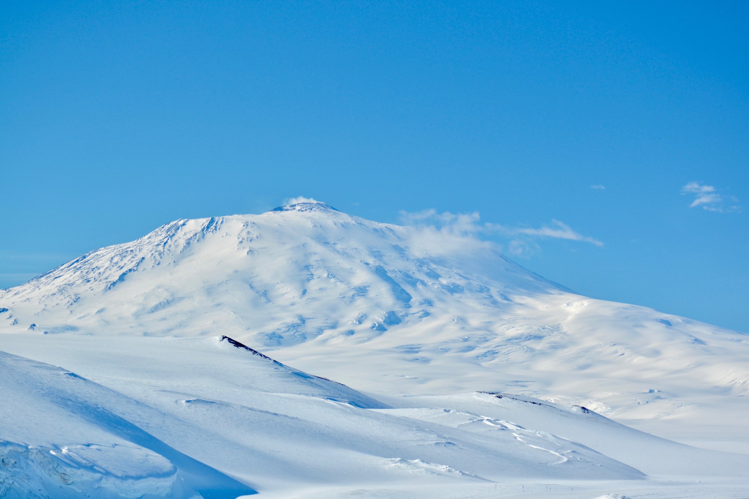
My appreciation manifested into concern, and I dove into environmentalism through school clubs, internships, and organizations. I was drawn to Earth Sciences because of my interest in climate systems and global climate change. Glaciers and Ice sheets have become particularly interesting to me in part because of their immense influence on climate and ocean circulation, but also I just think ice is super cool!

I began doing research for Professor Rachel Obbard, the Co-PI for the VeLveT Ice Project (The PI, or Principle Investigator, is Professor Erin Pettit, from the University of Alaska, Fairbanks) when I started at Dartmouth. Rachel is a specialist in ice microstructure, and I have been helping her create maps of the crystal orientation of ice samples. (More on that later too.) This is what’s brought me here -- joining the Velvet Ice team, writing this blog, and preparing for a big journey south!

The VeLveT Ice Project

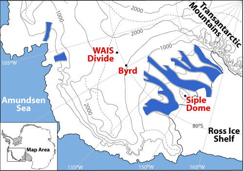
The title of our project is “Collaborative Research: VeLveT Ice - eVoLution of Fabric and Texture in Ice at WAIS Divide, West Antarctica,” and we are funded by the National Science Foundation, Division of Polar Programs. The Velvet Ice team is observing the ways in which ice crystal orientation affects the flow of ice sheets. Ice sheets contain records of Earth’s climate history. Scientists extract ice cores in order to study the layers that make up the ice sheet. The chemistry of the different layers reveals climate history, and the physical properties of the ice - crystal size, shape and orientation – tell us about the englacial environments (in which the layers formed), and both affect and are affected by the flow of the ice. By comparing variations in microstructure (crystal size, shape and orientation) to macrostructural deformation (flow of the ice sheet) we will gain a better understanding of the dynamics and history of the West Antarctic Ice Sheet (WAIS). A better of understanding of this history will improve other scientists’ analysis of the climate records the ice sheet holds. The borehole that remains after the collection of an ice core provides a means to study the large scale flow and deformation of the ice.

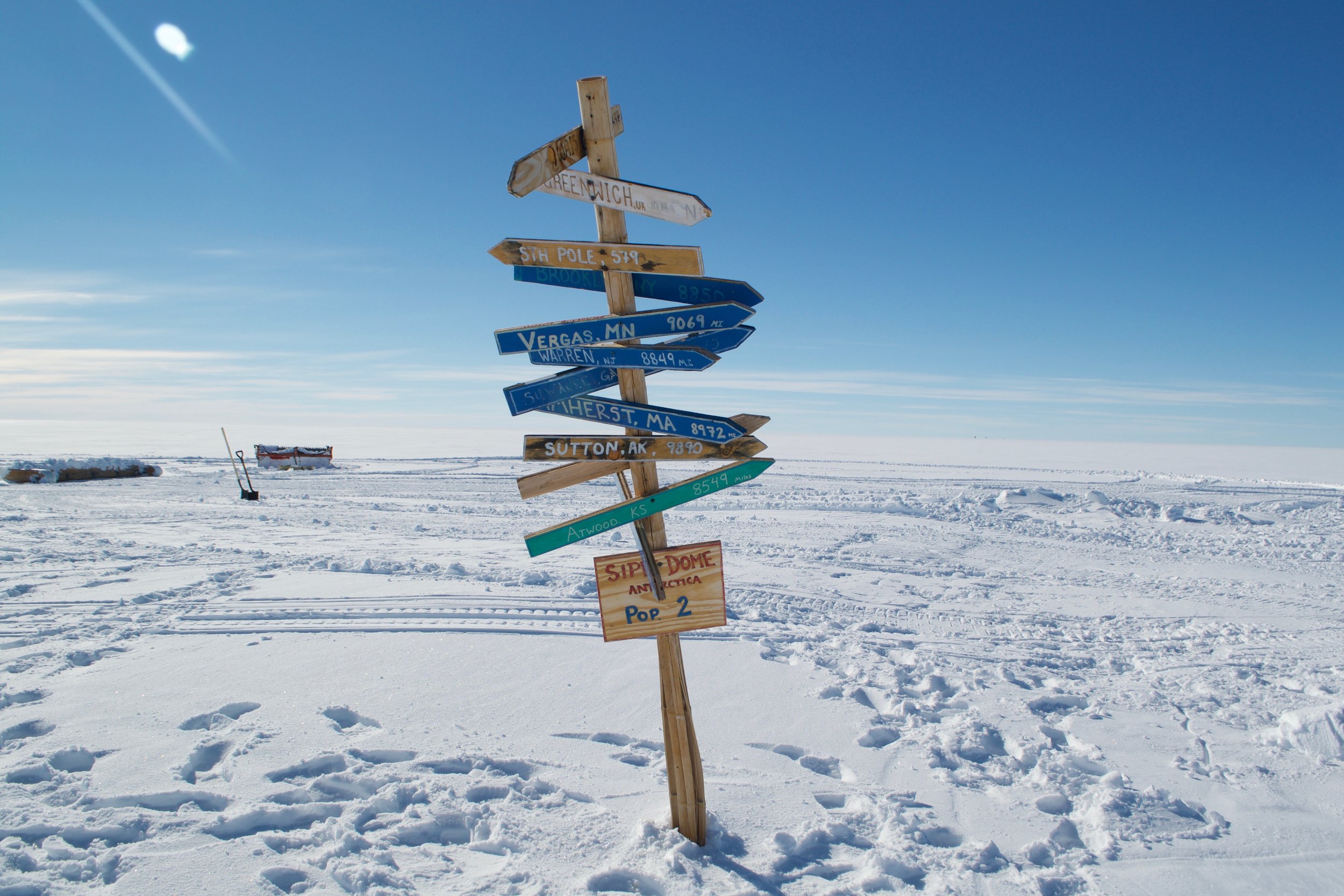
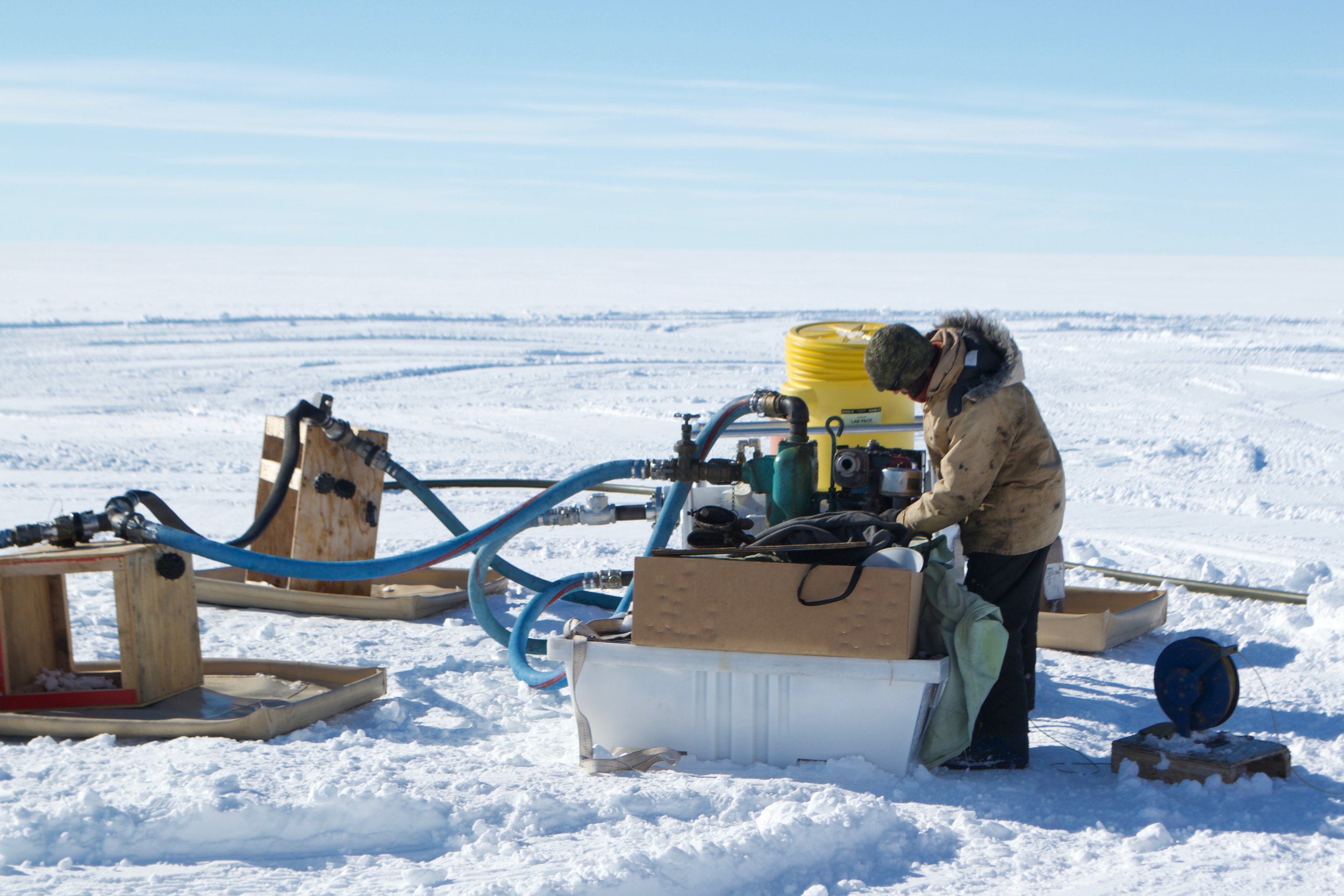
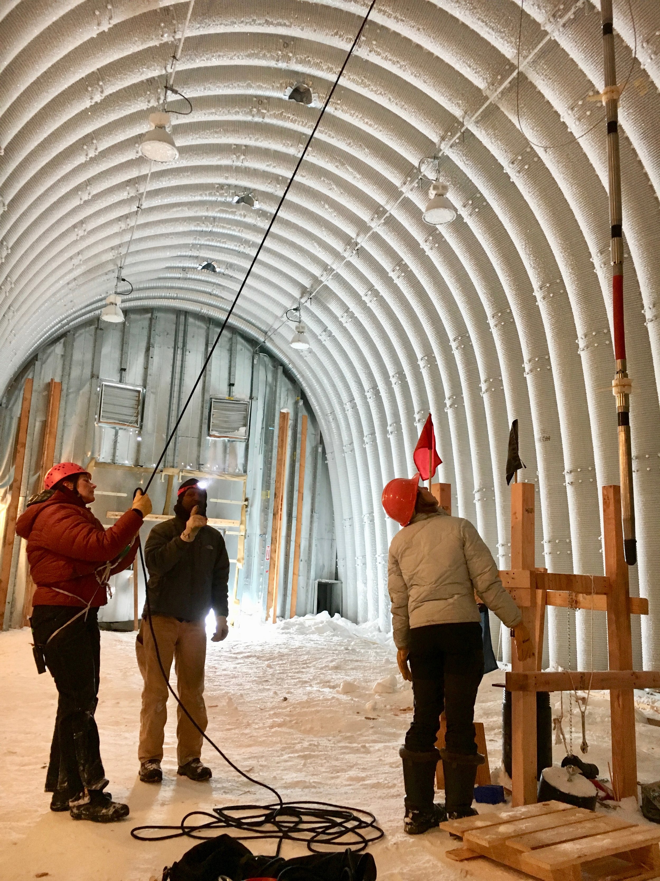
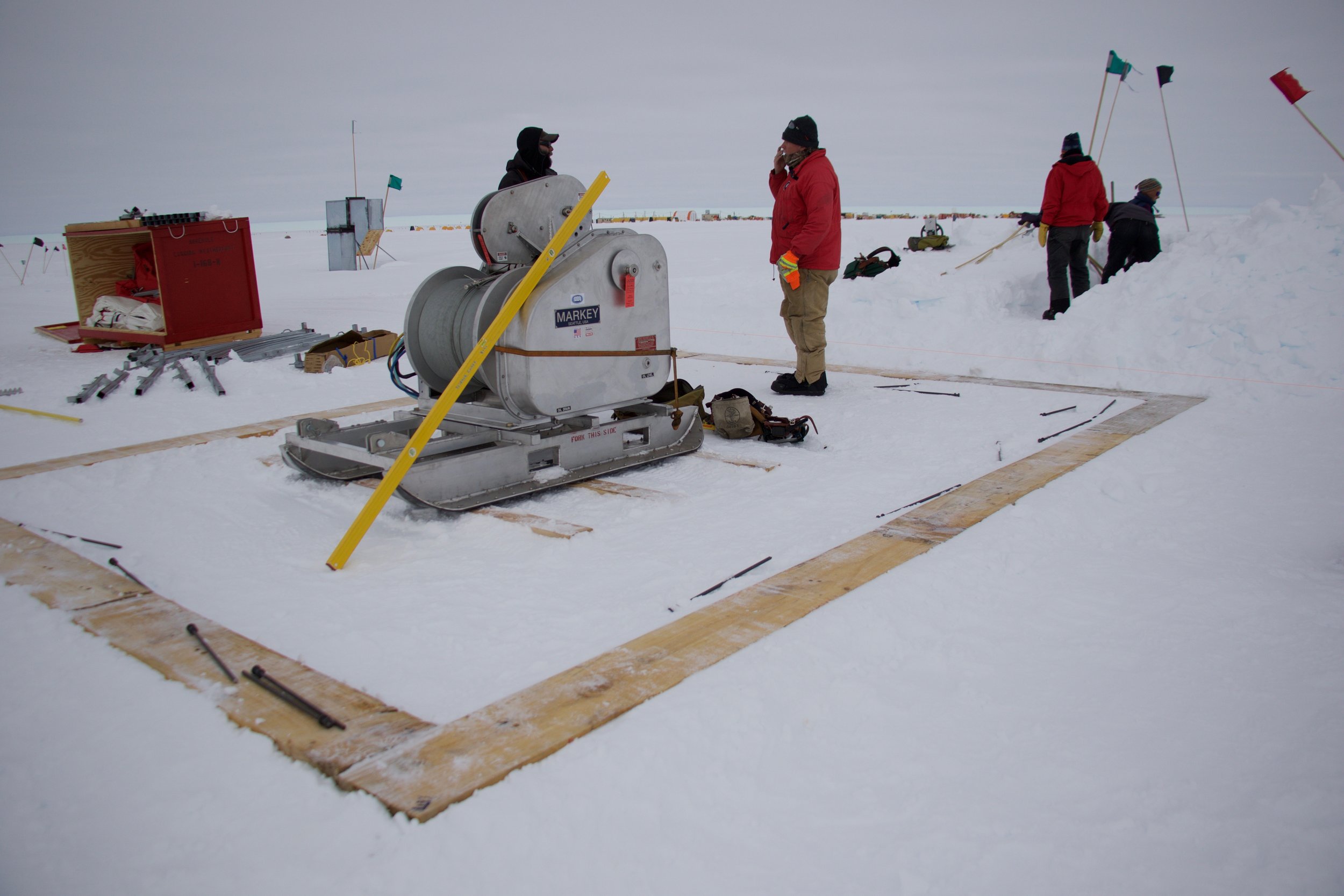
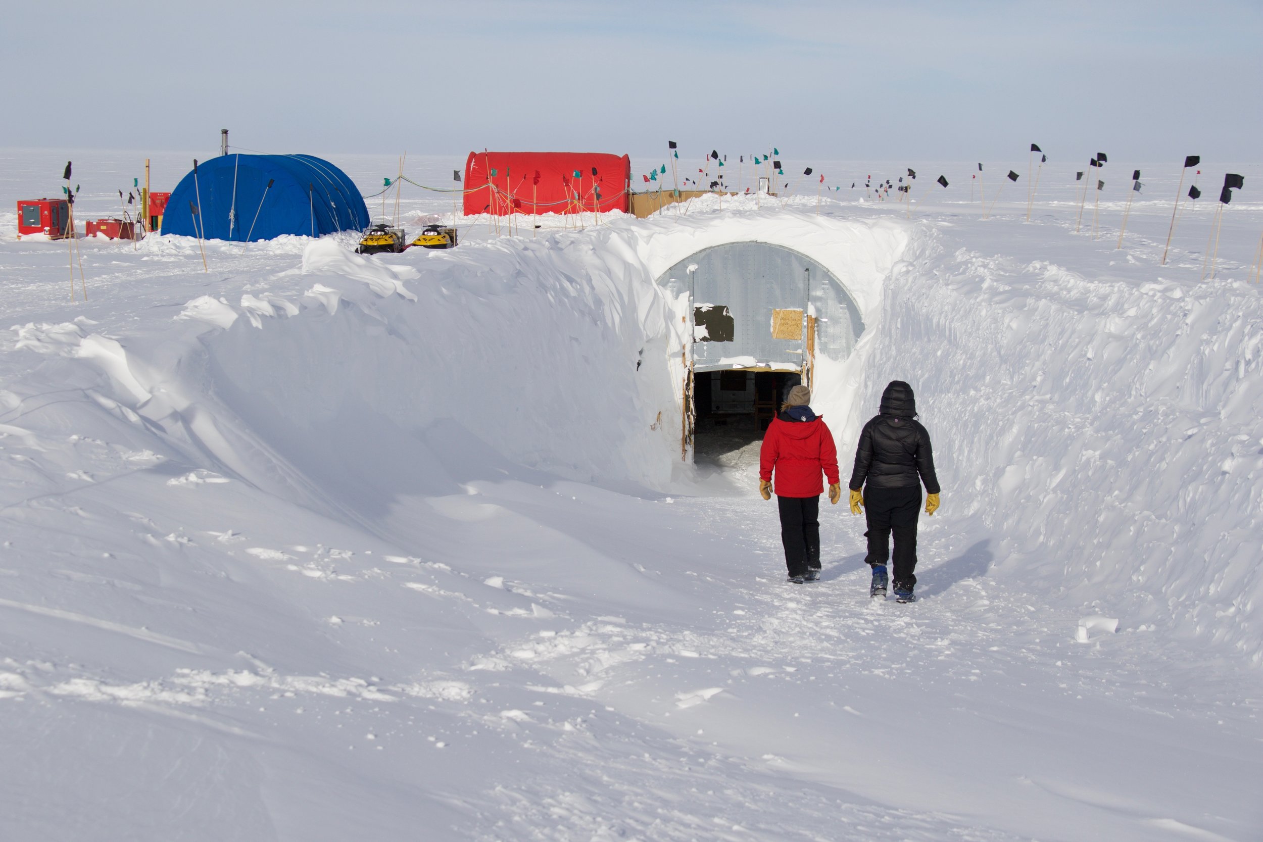
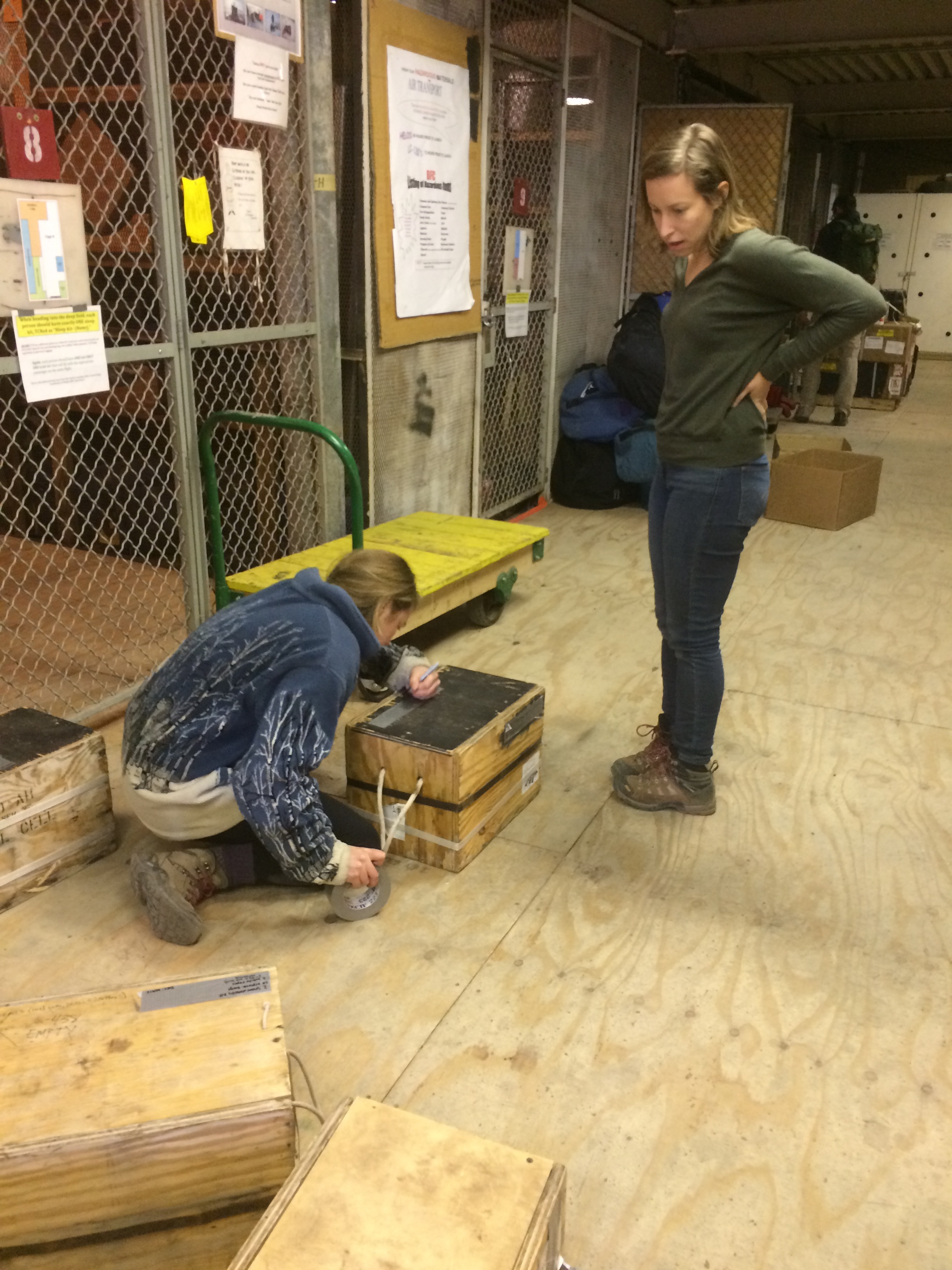
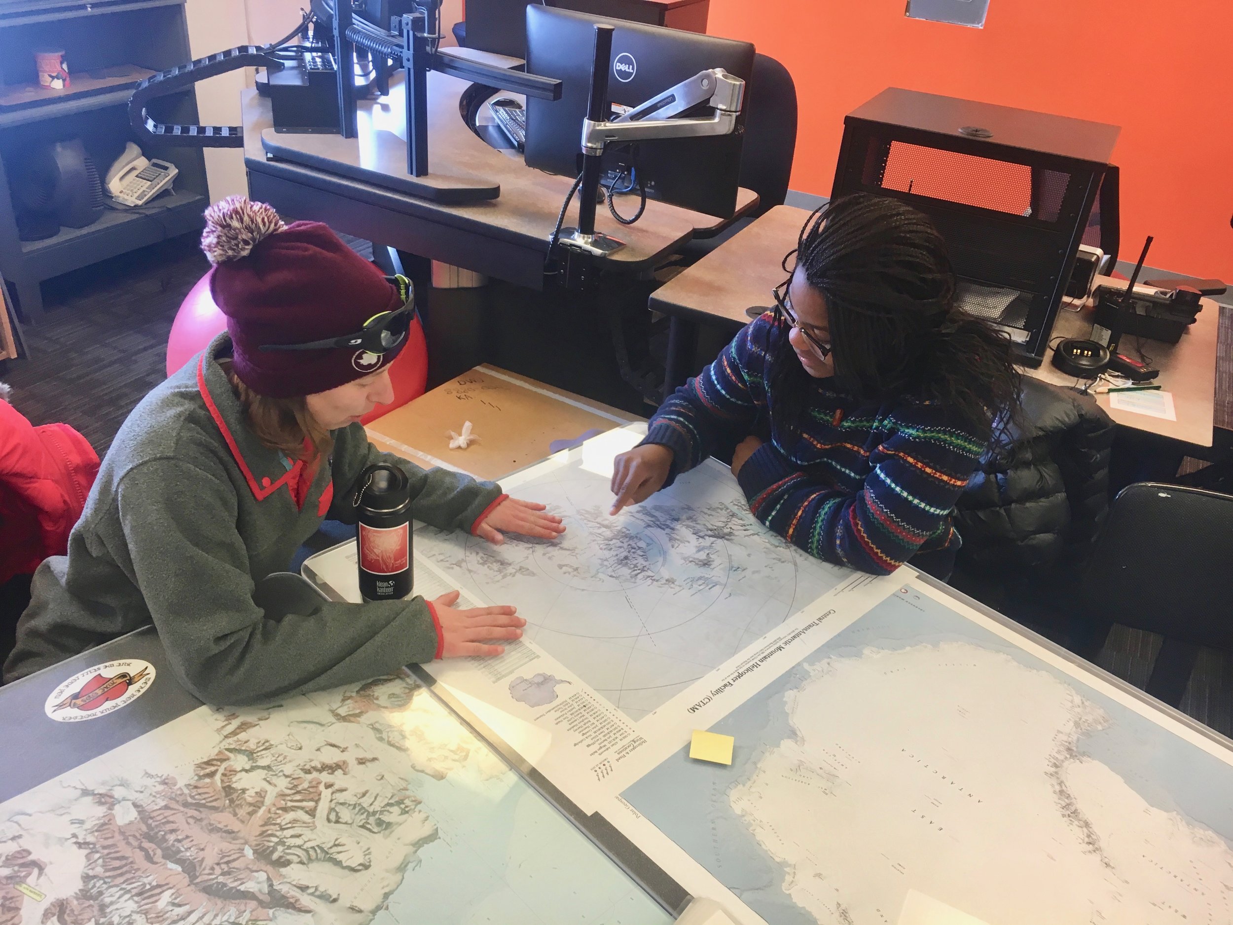
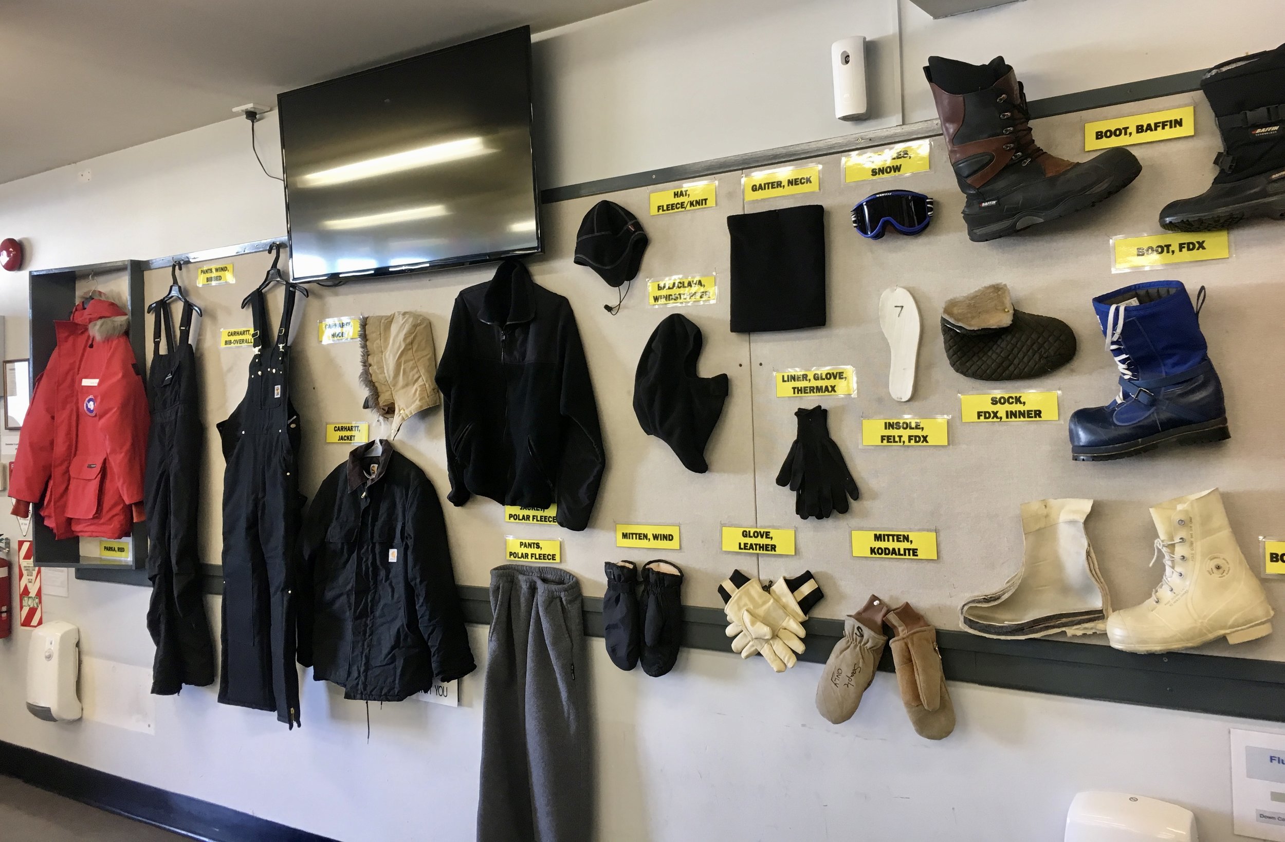
The WAIS Divide site was chosen in around 2003, based on what radar surveys told scientists about the relatively flat bedrock and horizontal layers of ice there. Over the years from 2009-2012, a 3405 meter ice core was extracted from the ice sheet. The borehole was left open, the drilling fluid is about the density of ice, and keeps the walls from collapsing. We will use several types of logging instruments, which we will lower into the borehole using a winch. As we lower and later raise the instruments, they will collect data about the borehole geometry and the stratigraphic layers. When we compare this to the borehole data we collected two years ago, we can see how much the ice sheet has moved at each depth.
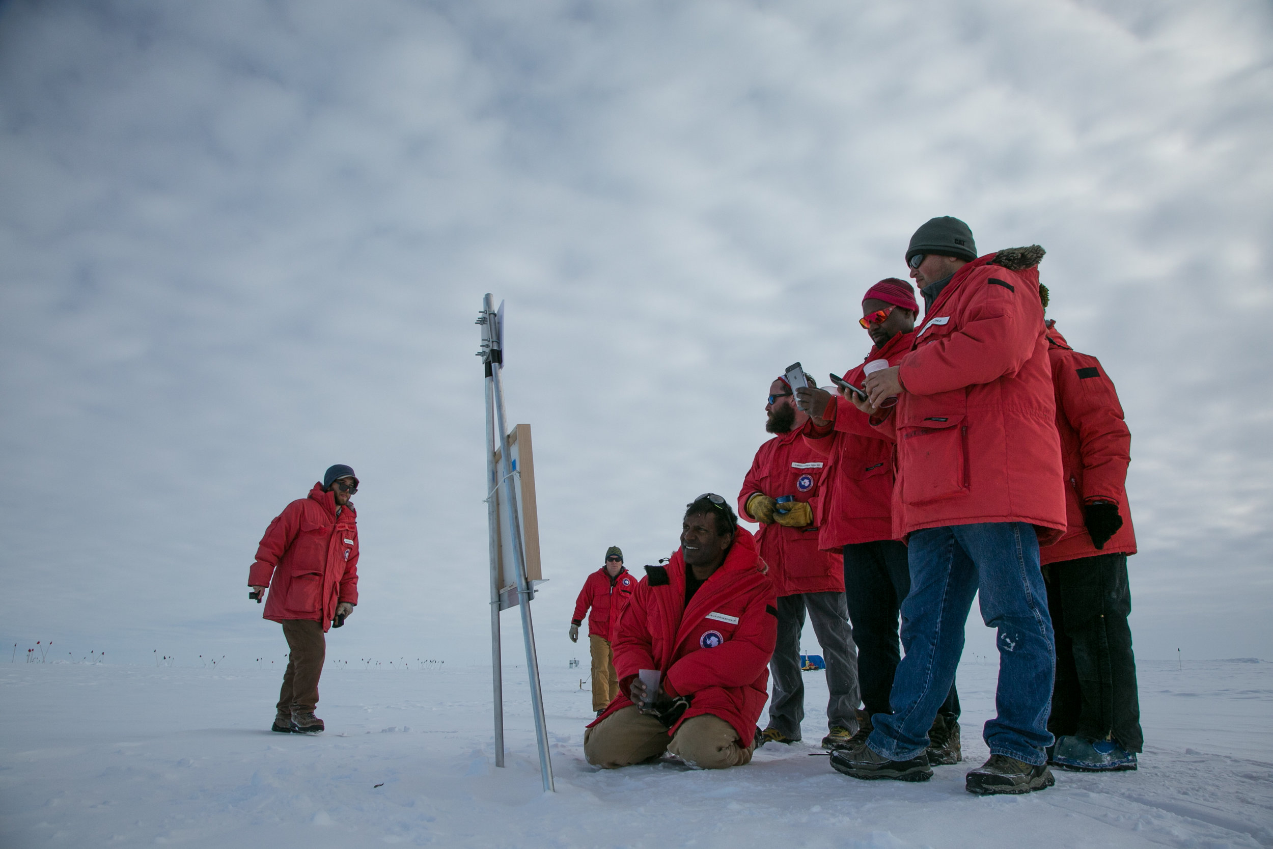
The Team

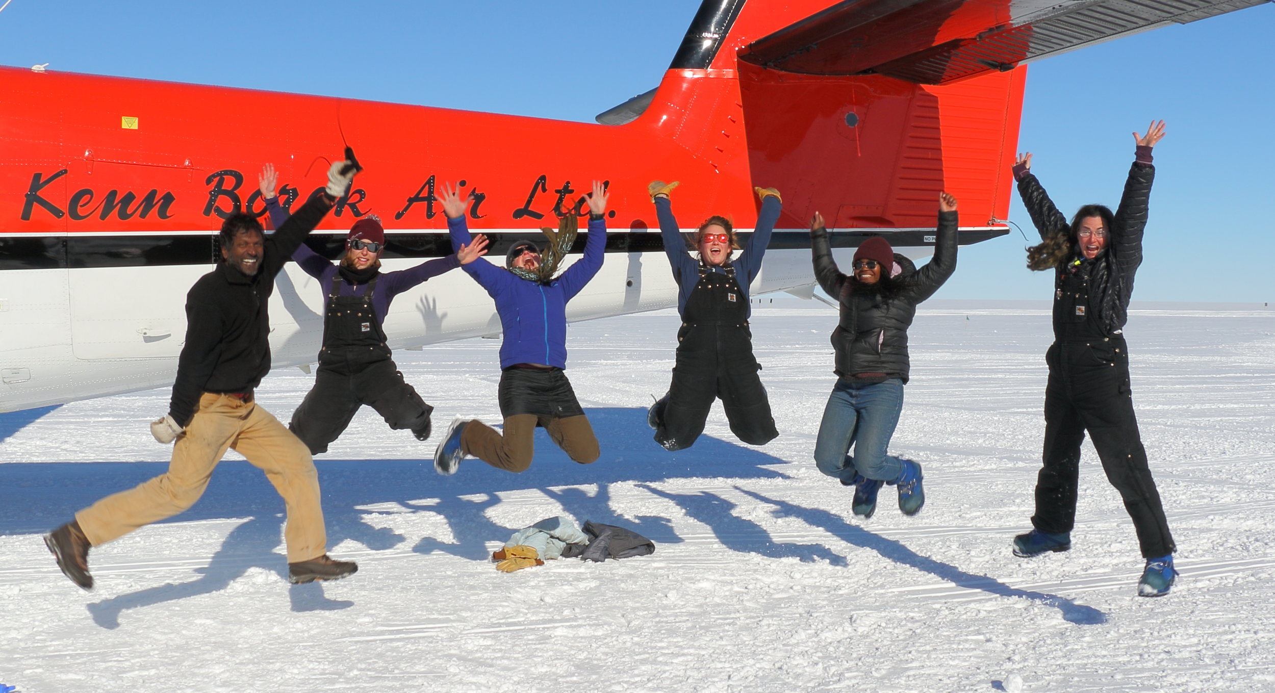
The VeLveT Ice Team consists of myself, Professor Erin Pettit (PI), Professor Rachel Obbard (Co-PI), Professor Sridhar Anandakrishnan (PI on a related project), Anny Sainvil, and Emilie Sinkler. PI stands for Principal Investigator. The PI is the team captain, in effect.

Erin Pettit

Erin.jpg

I am a scientist who explores and studies glaciers and glacierized landscapes to better understand and predict our changing climate and rising seas. My research teams work together and use a variety of tools to measure the movement glaciers, to watch the changes that happen in snow over a day or a week, to listen to cracking a popping of glaciers, to feel and record the

vibrations of ice quakes, and more. These observations helps us understand the flowing, fracturing, melting, and changing of glacier ice all over the world. Art is another means of exploring ideas and observing landscapes that I am passionate about. I like to teach students how art and science overlap and share many concepts about creativity, communication, and learning. In addition to my university teaching, I run a summer program for high school girls called Girls on Ice. We take girls out on field-science expeditions, where they learn, explore, and conduct research with glaciologists, geologists, biologists, mountain guides, and artists. I grew up surrounded by mountains in Seattle, Washington. Exploring these mountains as a kid drew me to combine my love of mountain landscapes with my interest in geology and my undergraduate degree in mechanical engineering to get a PhD in glaciology (a branch of geophysics). Because I also lived in Houston, Texas as a kid, which is a flat landscape filled with dense pine forests and slow moving rivers, I grew up with a strong appreciation of the many variations in landscapes on Earth.

Rachel Obbard

Rachel_headshot.jpg

I'm a materials scientist and engineer and I teach and do research at Dartmouth College. A materials scientist studies the structure of materials at the microscopic scale, and uses that information to explain and predict the behavior of the materials at much larger scales. I do most of my research on ice sheets and sea ice, but am interested in many different materials. I even teach a course on the materials used in sports equipment. This came about as a result of being an avid snowboarder.

My interests in earth science and in building things were evident early on. I wanted to be a detective when I grew up, but I have a hearing loss, so that wasn't in the cards. I like to think of what I do as a scientist as a kind of detective work. I look for clues and try to use them to tell a story. I feel lucky that I get to look for some of the clues in beautiful and remote places.

When not working, I read, snowboard, bicycle, garden and do puzzles. I live in a cohousing community on a farm in Vermont where we have horses, cows, chickens, sheep, cats, dogs, and a llama.

Sridhar Anandakrishnan

Sridhar-in-otter.jpg

I’m in the Department of Geosciences at Penn State University. I teach introductory geology classes (I use the awesome US National Park system to motivate the class because almost every geologic process is present at some Park or the other, from volcanoes to earthquakes to glaciers.)

I teach “geophysics”. There are a few fundamental physical forces that shape our planet: gravity (what holds us to the surface of the earth), heat (from the sun and from inside the earth), sound, the magnetic field, friction of rocks sliding past each other, and so on. Geophysics is where we put those forces to work for us. We can find out so much about the parts of the Earth we can’t touch and see by using those forces: what causes earthquakes? How about ocean currents? What’s at the center of the Earth? Geophysics helps us answer those questions.

I teach about “ice and climate”: what record do glaciers hold about past climate? What influence will climate change have on glaciers and sea level? And that’s what I’ll get doing at WAIS Divide - looking at the history of the ice sheet and trying to understand how it will respond to the warming climate.

I have too many cats (well, one can never have too many, but some people think 9 might be excessive), a dog, chickens, peacocks, a turkey, bees, and two horses. When they let me, I get on my bicycle and go for long rides. For vacation, I love to hike in the Adirondack Mountains in NY and swim in the beautiful lakes up there. I was born and grew up in India and have a ton of family there and love to visit as often as I can.

Emilie Sinkler

Emilie_Sinkler.jpg

I am a geophysics Ph.D. student at the University of Alaska Fairbanks and I research the flow of ice in ice sheets and glaciers. At WAIS Divide, I will be collecting data about how the borehole has changed shape and size over the last two years.

I have been interested in the natural world for as long as I can remember, but my interest in glaciology began midway through college when I took a numerical modeling course that explored glaciological topics like the snow to ice transition on a glacier.

When I am not in the office, you can find me hiking, skiing, reading, or knitting. I don't have any pets, so I am a perpetual dog-sitter and am the proud parent of many plants and a sourdough starter. Like many Fairbanksans, I live in a small "dry" cabin, meaning I don't have running water. My living situation is completely different from anything I have experienced before, but I enjoy living in a place with so many opportunities to get outside and see many amazing icy features like snow, permafrost, and glaciers.

Anny Sainvil

Sainvil_headshot.jpg

I am a current senior at Smith College majoring in geosciences and government. Throughout my undergraduate years, I've had the pleasure of conducting several research projects that helped me gain a better understanding of what I want to pursue after graduation. The summer before my junior year of college, I conducted research with the Hydrogeology and Geophysics department at the Colorado School of Mines through a program geared toward increasing the diversity in the geosciences called RESESS. We used a geophysical approach to understand how water flows underneath the surface of alpine meadows in Boulder, Colorado. This internship introduced me to geophysics and its many applications. I am particularly interested in reconstructing paleoclimate as a way of understanding climate change.

During the second semester of my junior year, I went abroad to New Zealand and studied at the University of Canterbury in Christchurch. Prior to starting university, I attended a geology field camp with Frontiers Abroad and had the amazing opportunity to explore New Zealand’s beautiful landscape. After going abroad, I participated in an undergraduate research program called the Keck Geology Consortium and conducted research in Iceland. During the project we looked for features that could tell us about the sequence of lava flow events in order to gain a better understanding of the evolution of the land after the Laki Eruption of 1783.

I really enjoy doing fieldwork and gaining exposure to different fields within geology (and I am excited to be going to such a fantastic location for the first time)! I am a lover of the outdoors, traveling, and sports. I grew up in the inner city of New York and would always escape to the mountains of New England during my summers. I was a varsity rower during my first three years at Smith and have been participating in the sport since my early high school years. My love for geology sparked in high school, after I participated in an expedition to Mount Baker with Girls on Ice.